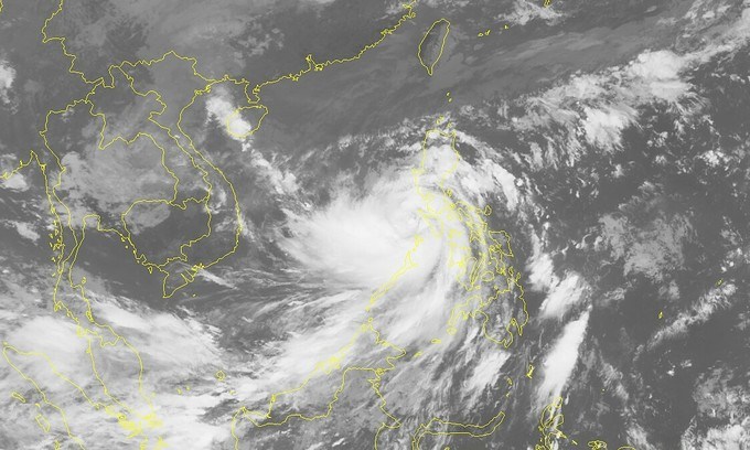
The storm was located 212 kilometers northeast of Song Tu Tay Island in Vietnam’s Truong Sa (Spratly) archipelago as of 8:00 am on Tuesday, according to Mai Van Khiem, director of the National Center for Hydro-meteorological Forecasting.
Average wind speed was at 135-165km per hour and gusts at up to 220km an hour.
Molave will travel northwest in the next 24 hours and will have been in the maritime area off the localities from central Da Nang City to south-central Phu Yen Province by 7:00 am on Wednesday.
Wind speed will slightly decrease to 135-150km per hour and gusts at up to 200km an hour.
The typhoon will make landfall between Da Nang and Phu Yen later the same day, before weakening into a tropical depression.
“This is the strongest storm to impact Vietnam so far this year, unleashing extremely strong winds and resulting in huge waves at sea,” Khiem stated.
Powerful winds will start hitting the coastal areas from north-central Quang Tri Province to south-central Binh Thuan Province from Tuesday afternoon.


