Nguyen Dinh Dau, born in 1920 in Hanoi, received his education at a French/Vietnamese primary school. It was during this time that he had the privilege of collaborating with Hoang Dao Thuy, a distinguished revolutionist and culturist in Vietnam, between 1940 and 1941. Dau’s significant contribution entailed the creation of a map depicting the region around West Lake. This endeavor ignited his profound interest in ancient maps of Vietnam.
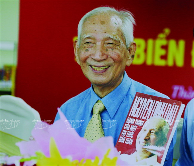 Prof. Nguyen Dinh Dau at a press conference to introduce his book entitled “Vietnam’s Sovereignty in the East Sea and over Hoang Sa – Truong Sa Archipelagoes” in June 2014. 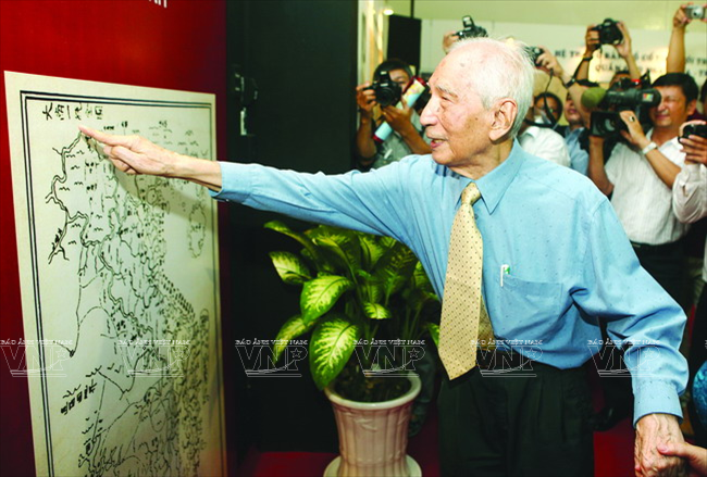 Prof. Nguyen Dinh Dau introduces an ancient map which depicts in detail Vietnam’s continental shelf, sea and islands. 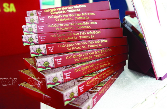
“Vietnam’s Sovereignty in the East Sea and over Hoang Sa – Truong Sa Archipelagoes”. |
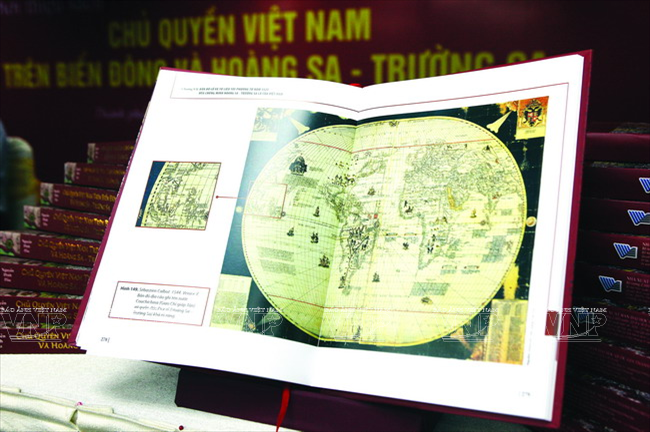
Professor Nguyen Dinh Dau possesses a remarkable collection of over 3,000 ancient maps, including several highly valuable ones that offer detailed accounts of Vietnam’s continental shelf and islands. These maps are an invaluable resource for Vietnamese researchers, providing indisputable evidence to support Vietnam’s sovereignty over the Hoang Sa and Truong Sa Archipelagos. Among the collection are artifacts dating back to the 15th century and unique pieces that are not held by the Ministry of Natural Resources and Environment. The majority of these maps were obtained from foreign countries, with the exception of one map which Professor Nguyen Dinh Dau meticulously recreated due to copyright restrictions imposed by the National Library of France in Paris.
Professor Nguyen Dinh Dau highlights the importance of maps within the realm of research, as they offer valuable insights into historical and geographical subjects. He affirms that maps serve as precise and scientific evidence, aiding in the discovery of truth within the realm of history. As a researcher, he heavily relies on ancient maps and land registers from Vietnam to unveil the nation’s historical trajectory, encompassing a diverse range of periods characterized by growth and turmoil.
After extensive research on historical maps, it has been observed that Chinese maps dating back to the 15th century or earlier, up until the early 20th century, referred to the sea east of Vietnam as Giao Chi Duong (Giao Chi being one of Vietnam’s former names) or Dong Duong Dai Hai or Dong Nam Hai. Additionally, a map created by Portuguese navigator Diogo Ribeiro mentions that the coast of Pracel is located in present-day coastal province of Quang Ngai. In 1525, while exploring the East Sea, Diogo Ribeiro came across the Pracel Archipelago, commonly known as Hoang Sa and Truong Sa in the Western world. He classified these archipelagos as part of Cochin (represented phonetically as Giao Chi by Westerners).
During a recent presentation, Prof. Nguyen Dinh Dau eloquently discussed Vietnam’s insistence on its sovereignty over the Hoang Sa and Truong Sa islands. Supporting his claims, he presented a compelling range of evidence in the form of world maps meticulously crafted by esteemed western cartographers from the 16th to the 19th centuries. These distinguished maps unequivocally depict the Paracel or Pracel islands, situated in the East Sea, just off the coast of Vietnam’s Quang Nam-Khanh Hoa Province. Noticeably absent from these historical cartographic records are any indications of the Paracel coast belonging to South China, the Philippines, or Malaysia. This undeniable historical documentation overwhelmingly vindicates Vietnam’s rightful ownership of the Hoang Sa and Truong Sa islands.
During the “Sea and Islands of Vietnam” week, held in Ho Chi Minh City from June 1-8, Professor Nguyen Dinh Dau presented his significant publication titled “Vietnam’s Sovereignty in the East Sea and over Hoang Sa – Truong Sa.” This authoritative resource focuses on the historical evidence and legal foundations that establish Vietnam’s sovereignty over these territories. With a comprehensive and impartial approach, Professor Dau offers scientists, authorities, and the general public a thorough understanding of the issues surrounding Vietnam’s sovereignty over Hoang Sa and Truong Sa. This valuable scientific publication also plays a crucial role in resolving disputes in the East Sea in accordance with international law.
Associate Professor Phan Thanh Binh, the Director of Ho Chi Minh City National University, highlighted the immense historical significance of the work undertaken by Vietnamese scientist Prof. Nguyen Dinh Dau on the East Sea, Hoang Sa, and Truong Sa. Prof. Dau’s meticulous and comprehensive research serves as a tribute to his unwavering dedication and lifelong commitment to preserving and documenting Vietnam’s territorial claims.
| Researcher Nguyen Dinh Dau was presented the Tran Van Giau Award in 2005 for his research relating to land registers in the Nguyen Dynasty in six provinces in the South and the 2008 Research Award granted by Phan Chu Trinh Cultural Foundation for his great contributions to the field of research. He also sets a national record for his book about official names and borders of Vietnam and collecting the largest number of ancient and modern maps about Vietnam’s Hoang Sa and Truong Sa Archipelagoes. |


