Nestled within the Hoang Lien Son mountain range, Putaleng stands as a majestic peak in Tam Duong District, Lai Chau Province, ranking third in height among neighboring giants Fansipan and Pusilung.
Leading to its summit, verdant forests cloak the slopes, adorned with towering centenarian trees and dense bamboo groves. Cascading waterfalls and gurgling streams offer respite to intrepid hikers.
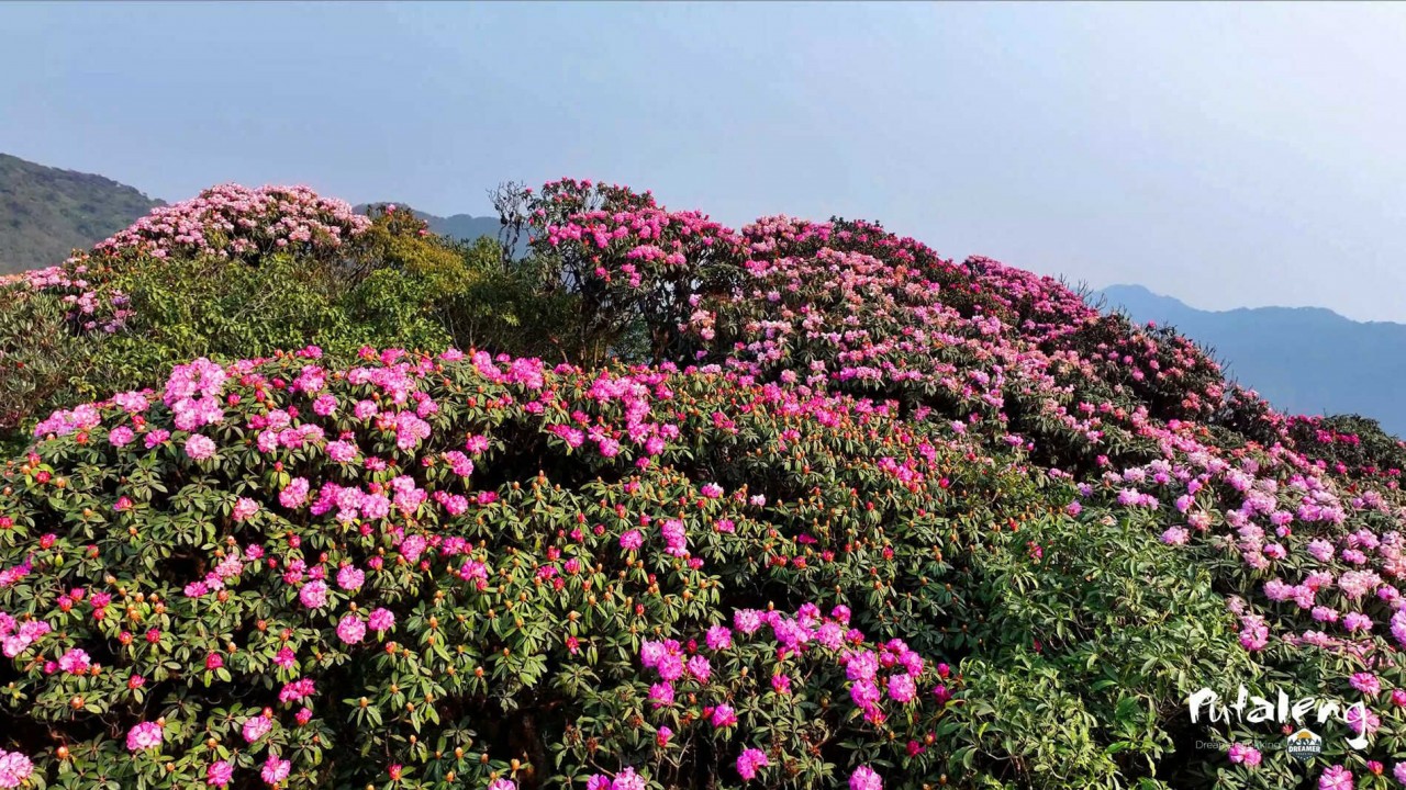 |
| From February to April, this destination captivates with vibrant azalea blooms. Photo: Dreamer Trekking |
From February to April, Putaleng transforms into a spectacle as vibrant azalea blossoms erupt in a kaleidoscope of pink and orange hues.
Amidst this floral tapestry, a picturesque azalea hill graces the trail between Si Thau Chai and Ta Leng. This is where the most abundant and breathtaking blossoms thrive. Hikers embark on a day’s journey from here to conquer the towering 3,049-meter Putaleng Peak.
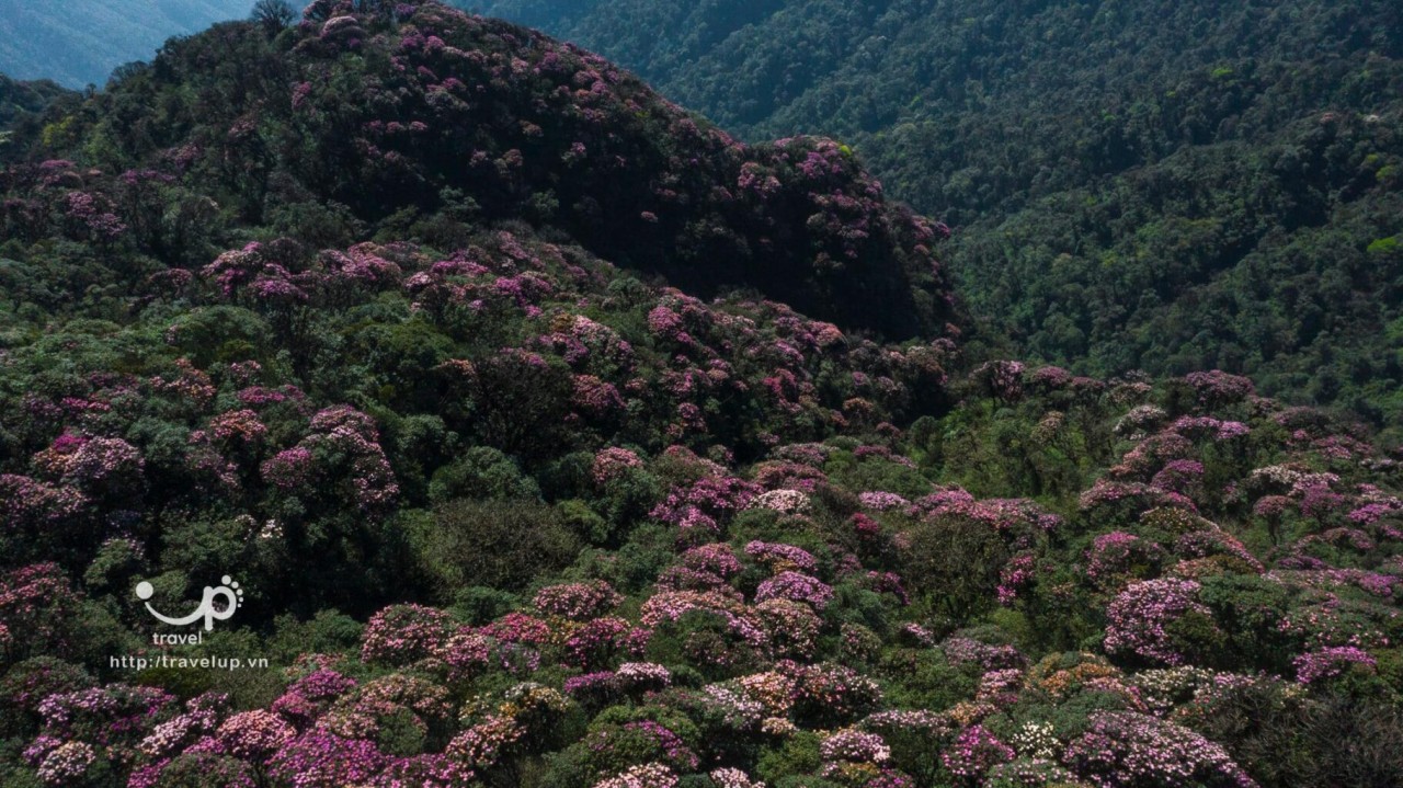
To fully appreciate the grandeur of the azalea spectacle, dawn and dusk offer the most enchanting vistas. With around 850-1,000 species, azaleas symbolize enduring vitality. In Vietnam, the Hoang Lien mountain range (Sa Pa) hosts an array of native azalea varieties.
 |
| Witness the ethereal beauty of azaleas at dawn or dusk. Photo: TravelUp |
Azaleas burst forth in a vibrant symphony of white, yellow, pink, red, and purple, creating an otherworldly ambiance. Amidst swirling mist and ethereal light, trekkers can immerse themselves in the serenity of the moment, lulled by the murmur of streams, the songs of birds, and the gentle caress of the wind, momentarily escaping the mundane.
Four distinct trails lead to the summit, originating from Si Thau Chai Village, Ho Thau Village, Sin Chai Village, and Ta Leng Village, all within Tam Duong District, Lai Chau Province.
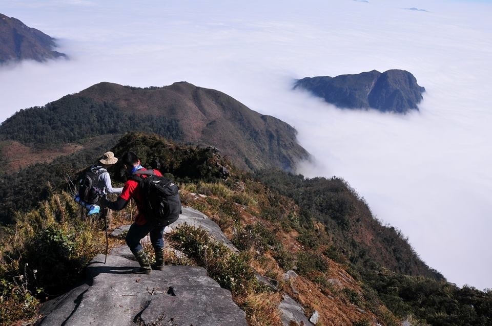 |
| Hikers revel in their trek to the summit. Photo: Traveloka |
The most challenging route commences from Si Thau Chai Village, spanning over 16 arduous kilometers. Steep slopes, swinging ropes, and treacherous ladders test the endurance of hikers, but the reward is an unparalleled panorama of the surrounding wilderness.
Throughout their ascent of Putaleng, hikers pause on flat rock surfaces to relish the symphony of the wind rustling through the dense bamboo forest.
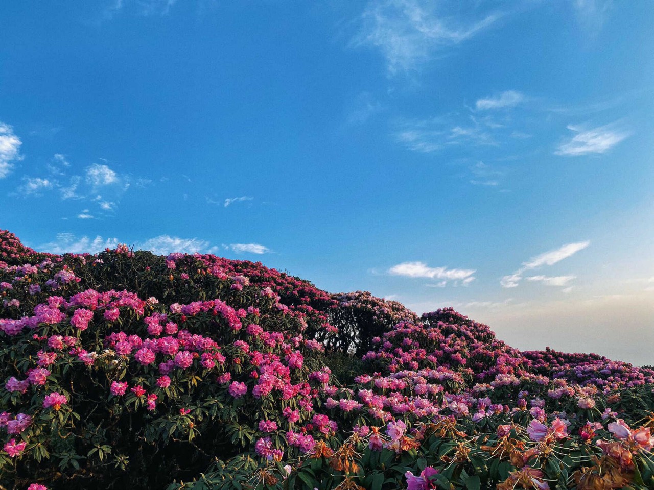 |
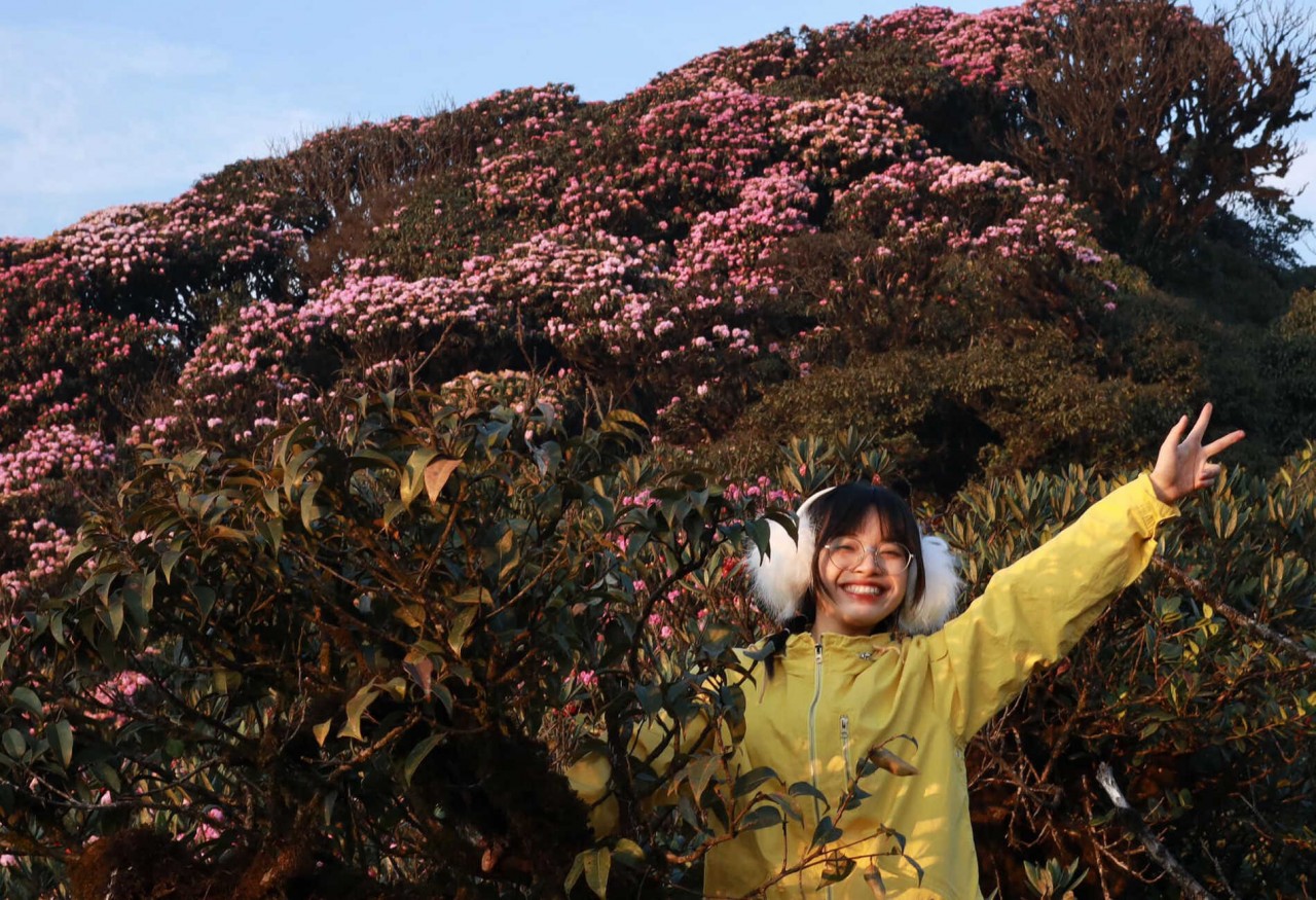
| Azaleas, with their vibrant hues, adorn the landscape. Photo: Nguyen Hoang Yen |
They marvel at the iridescent hues of blooming azaleas, their petals shimmering under the golden rays of the sun.
Lai Chau, nestled in the mountainous embrace of Northwest Vietnam, north of the Da River, shares borders with Yunnan (China) to the north, Laos to the west, Lao Cai Province to the north-east, and Dien Bien and Son La provinces to the south.
A network of mountains defines the landscape. The highest peak, Pu Sa Leng, towers at 3,096 meters. Sloping mountains, rolling hills, fertile valleys, and expansive plateaus alternate throughout the region. Majestic waterfalls and cascading rivers hold the potential for hydroelectric power generation.
 |
| Azaleas paint the landscape in vibrant hues. Photo: Nguyen Hoang Yen |
From April to early June, Lai Chau’s rice terraces brim with water, creating a picturesque backdrop for photography enthusiasts. This period offers an exceptional opportunity to delve into the unique culture of Vietnamese rice cultivation in mountainous areas.
Seekers of solitude may wish to avoid the peak season crowds that flock to Lai Chau in October, January, and June.


