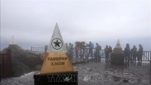
This height is more than 4 metres higher than the measurement that has been officially used in many documents over the past 110 years – 3,143 metres as measured by the French in 1909, the department said at a press conference in Hanoi on June 26.
Director of the department Phan Duc Hieu said the latest measurement of the Fansipan peak was carried out using the Global Navigation Satellite System (GNSS) in combination with the altitude data provided by some national satellite positioning stations and other modern technologies.
Hence, the department’s centre for surveying and processing measurement data proposed the Appraisal Council recognise the height of the Fansipan peak as 3,147.3 metres.
Fansipan is the highest mountain in the Hoang Lien Son range in Sa Pa town, Lao Cai province. It is recognised as the highest peak in Vietnam and Indochina.
Located in the northwest of Vietnam, Sa Pa town is 1,600 metres above sea level, 33 km from Lao Cai city. It was discovered in 1903 by the French and boasts many natural scenic sites such as Ham Rong Mountain, Thac Bac (Silver Waterfall), Cau May (Rattan Bridge), Bamboo Forest and Ta Phin Cave.


